
Monitoring the condition of the land
Host: Hodgson River Station
Written by: Jo Bloomfield – Owner, Hodgson River Station.
In the early 1990’s a Pastoral land care group in Alice Springs, solely as an initiative of the producers developed a system of land monitoring. This is taking a photograph and recordings of a set site after a rain event or at a set time to act as a long term time lapse series of photos.
It had a number of purposes to act as a management record by which a producer can record rainfall, events such as fire, dry periods, and land management use such as stocking rates. It was also a way to record changes in grasses and tree compositions in a format that was useable and relatively easy to understand and often in ‘our language’ without all the scientific names, but recording information we felt was relevant and useful for environmental long term management. Most producers have this information in their heads and think about it all the time but often it’s not documented and therefore the monitoring sites recordings acted as way to keep important information in a simple process to trace and logical useable format to assess.
Another purpose for us to establish monitoring sites was to repute misinformation. On a previous property we had there was a main tourist road travelling through the place which meant it was frequently travelled by environmentalists and people who viewed cattle grazing as detrimental to the environment. On one occasion a person wrote a particularly blasphemous article on land degradation citing our property and the cattle they’d seen dead at one area, the reason for these deaths in their view was that the animals had died of starvation, poor management, rah rah rah, cattle and cattle producer hater typical rant. The author didn’t even have the decency to ask us about the areas they travelled before they published, never thought to contact us to ask what the bones were or a significant drought strategy plan we had in plan when in drought. The truth was the carcases they had seen were feral camels we had shot two years before and were in carcase heaps we had pulled together to burn to stop the bones being consumed by other animals. At times we would shoot herds of 20-30 large camels at a time so you can imagine one of the bone heaps this person seen. It wasn’t a drought period, actually the cattle were in good condition and this person had absolutely no idea as to what they were talking about. They had made baseless accusations and I had nothing to cite to shove in their face to pull them into line which they so deserved, all I had was my word, and of course who believes a pastoralist who actually wants to care for the land when they run cattle and use the resources for their economic gain!
Therefore I have always embraced the monitoring site concept. We don’t use these photographs solely to base business decisions on but sometimes they are a tool and can be an indicator of issues arising, such as weeds and cattle impact and therefore adjustments to management can occur or be conducted in small stages rather than wait for the lightning bolt moment of realisation when a weed or erosion problem has got too far to be corrected.
The land monitoring system was picked up the government some years later and is now also part of our lease requirements that we keep a documented record of these sites. While I don’t feel the need to divulge all my records to government I do keep records as to the historical nature concerning the finite business operations of land utilisation. I also have sites that are solely for our use of recording and analysis.
Initially a site is chosen that is a fair representation of a general area, not a point that is extremely close to a developed site, e.g. where heavy traffic of vehicles or animals occurs but a general overlay of the land system and grasses in a natural but utilised vicinity. Depending on the property size there may be a several monitoring sites in each paddock, with each property having 10-20 sites to record. This depends on land systems, topography, and personal enthusiasm of the producer in many ways. It is a big job to do this and one that requires consistency. Unfortunately at times, years are missed and the photos don’t always get done at the same periods.
When setting an up a site we record GPS coordinates and mark the site with two pickets, this enables a set way to take the photo to try to have following photographs as similar in direction and line of sight as possible.
Historical information is recorded – rain fall of the previous 12 months, consistency of the rain, fire events, animal grazing use, and anything the producer feels is important and useful to them to record. Such as evidence of erosion or soil/rock composition in the area. Type of land system the site is in, rocky, heavy black soils, sand etc.
Each time we take a new photo, we will record the principal species of grasses, shrubs, trees, and their abundance over an area of about 50m2. This is a fairly broad estimate of ground coverage and noting if the grass/tree ration is decreasing, increasing or if woody weeds are an issue. Notes are kept of occurrence of preferred species to weeds or increase and decrease in particular types of grasses. If a significant factor we may also include records of feral animal impact and issues of management of that particular site.
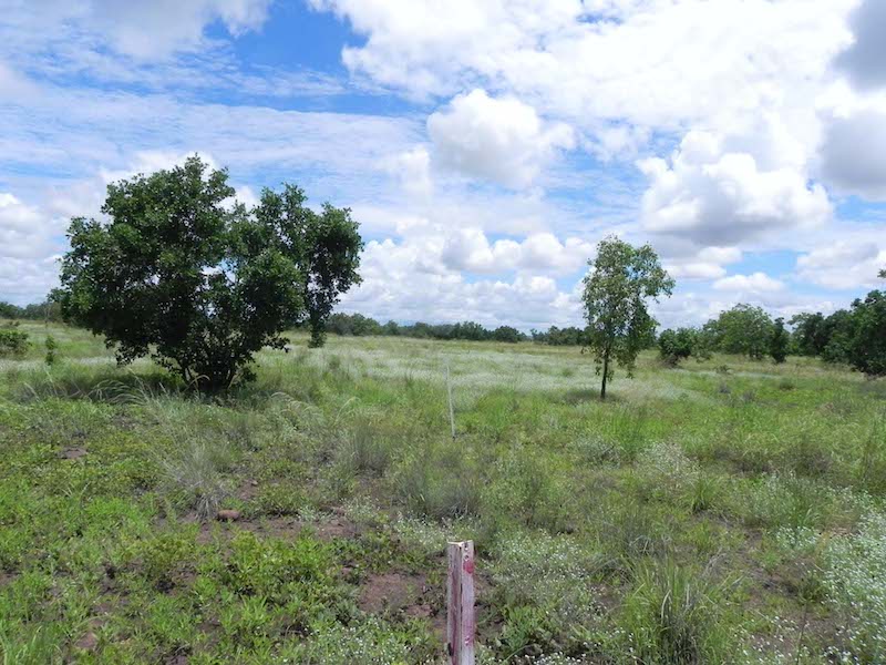
The following photographs are of one monitoring site, I have taken out only a few photos to fit in the blog, some records are from the previous owners.
Some of these photographs are very poor quality as film quality and camera abilities have changed over the years. Time the photograph has been taken can also affect the quality of the image.
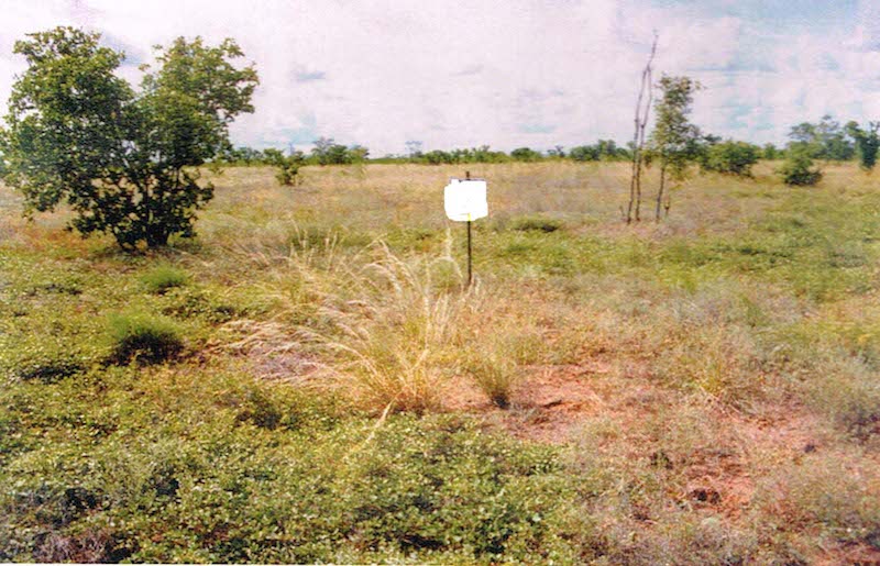 April 1996.
The 1995/96 we season had been very good with March being particularly heavy and even showers in April. Pasture condition is recorded as good, with land condition also good with no obvious degradation or erosion. With no stock being present over the wet and only lightly stocked in the previous dry. Dominant grasses are recorded as Feathertop three awn, Flinders, and Couch. The topography of the area is a heavy black soil flat located on a basalt rock plateau.
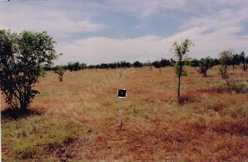 May 2003.
The wet season of 2002/2003 had been a boom and bust affair with very little in the late of 2002 and massive falls in a period of a week in January. February and March had lighter falls consistently over a number of weeks. While the wet season had been large in volume of only 1-2 events and likely hot weather that followed the couch grasses would be the dominate species as it likes the warm and dry following rain. Couch is ok as a pasture grass but the more preferred Flinders and golden beards need the sustained moisture to grow bulk and seed. Pasture condition at this point was recorded as fair. As a producer they would realise that this area’s feed will diminish quickly with the dry season and intensity of grazing would need to be controlled for animal and land health.
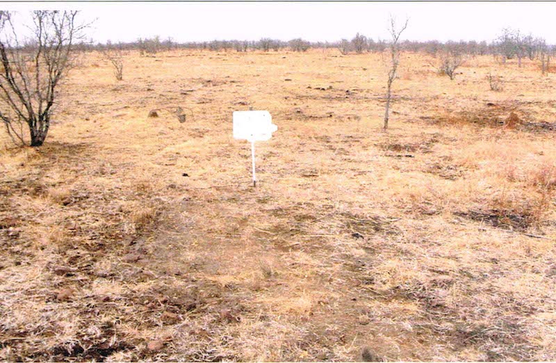 Nov 2003.
No rain has been recorded since March, No record was made of the stock being removed but at this point in time the dry matter available would have little or no nutritional value. No records of fire are written but I would say none occurred as this area is in a very well protected zone of roads and fire breaks to try to prevent fire incursion. Pasture condition is very poor. Land condition is still good as the soils are relatively stable though at a very natural dry stage for this time of year.
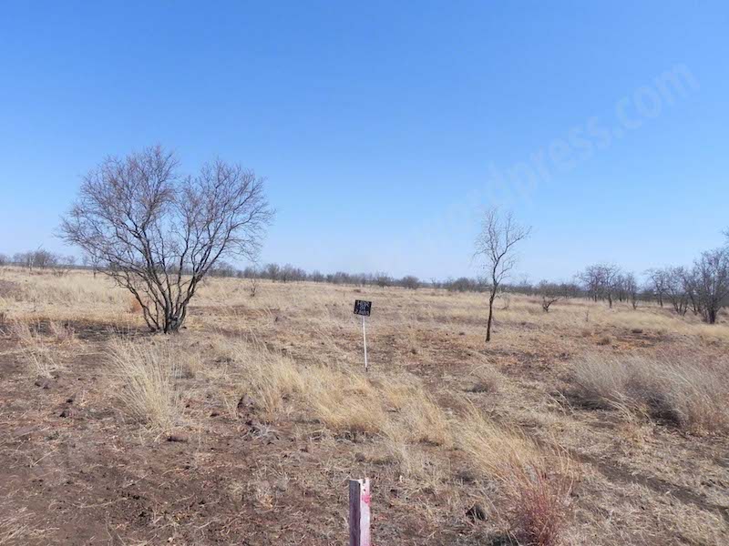 Nov 2013.
2012/2013 had been a very average wet season, with good rain only really falling over a period of a few weeks in December which caused any feed growth to be dried and burnt off when further rain was received in March. The seasonal growth of body and volume simply did not occur in the 2012/13 wet. Due to other paddocks all so suffering from poor seasonal growth we used this paddock as a holding paddock for younger cattle. It was stocked heavier than it should have been for a number of months. The pasture condition at this stage is poor, the larger grasses in the mid to left are bunched spear grass which at this point have no nutritional value, the right dried off grasses would be dried Feathertop. Again of little nutritional value now but very important as remaining stands for the fact they hold the soil together and help stop erosion. The cattle pad now evident is a concern as the land does slope to the right and if this pad becomes water gully could potentially cause unwanted soil erosion and gullies.
 Feb 2014.
I took this for the blog. The 13/14 wet has been reasonable with good showers over a consistent period of time. This is beneficial to good grass body growth in bulk and as can be seen as most areas look well covered except some in the lower part of the picture. Pasture condition at this stage is good, though predominantly made up of short living herbages that will dry off once the wet stops. Land condition is good with the cattle pad not causing problems for water flow. The only animals in this paddock are a handful of old stock horses. The whole area has been allowed to rest and regenerate over the wet and unlikely to be used during this dry for cattle. More work was done on pasture improvement at another site and the decision was made to utilise more hay feeding to weaners towards the end of the dry last year and will again be done this year to save heavy grazing pressure of this paddock.
As can be seen over this set of photos showing an 18 year period the land utilisation can be seen and assessed. It is a paddock that while lightly stocked can regenerate and be very sustainable in fodder supply, as a heavily stocked site it would degrade rapidly and degenerate over a short period of time.
I know from other producers this type of land system does not like fire, for some reason the plants on these rocky outcrops with black soil find it very difficult to regenerate after a fire period therefore it is important we manage fire access through this area. Which we do by limiting the access fire can have.There are no known weed problems associated with the site and the tree/pasture balance seems to have remained unchanged with indicates it is a stable plant ecosystem. Soil stability is very good at the site with natural creek systems and slopes in other areas allowing natural water shed without degradation to the land type and surface soils. Ideally I would like to see an increase of the preferred palatable plant species.
I hope you have enjoyed my blog articles this week, thanks Central Station, Jane and Steph for giving me the opportunity to post them.
Good luck every one, may your families be strong and safe, it rains plenty, and we have good markets. Cheers Jo Bloomfield